
Asset Intelligence
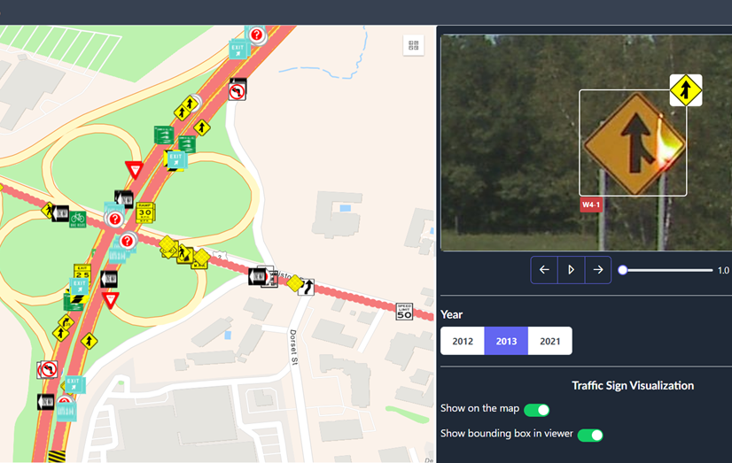
Detect, classify, and geo-locate signs, guardrails, and safety assets automatically and keep your inventory audit-ready.
- Autonomous traffic sign and asset identification from street imagery.
- Accurate GPS location tracking for every detected asset.
- Each asset automatically geo-tagged, time-stamped, and tagged for search.
- Detect missing or damaged assets across multiple years of imagery.
Traffic Sign Inventory
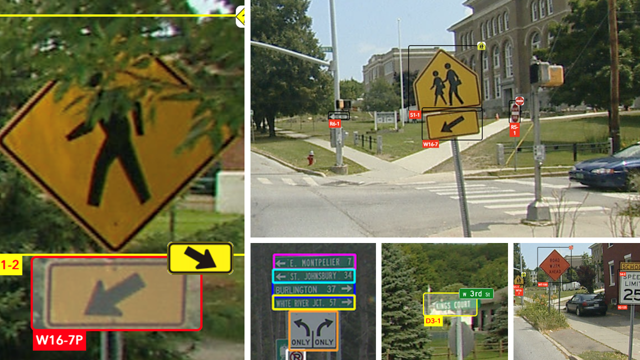
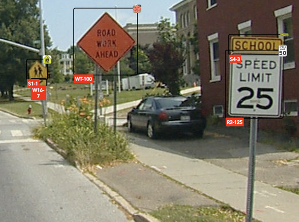
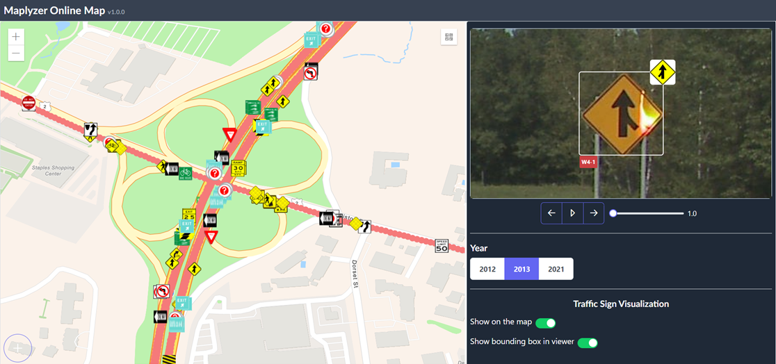
Maplyzer's AI automatically identifies and classifies traffic signs from street-level imagery and video, capturing type, condition, and GPS location for every sign it finds. Results are geo-tagged, time-stamped, and grouped for easy searching, sorting, and export.
Because the same imagery can be reprocessed year over year, missing or newly added signs are flagged automatically so a sign that comes down doesn't sit unnoticed until the next scheduled inspection.
Guardrail Inventory
The same detection pipeline that inventories signs applies to guardrails and other roadside safety hardware extracted from imagery, placed on the map, and tracked for presence and condition across every year of coverage you have.
Because every detection carries a timestamp and location, guardrail sections can be compared pass over pass to surface exactly where hardware has been damaged, removed, or never replaced after an incident.
MIRE Compliance Made Simple
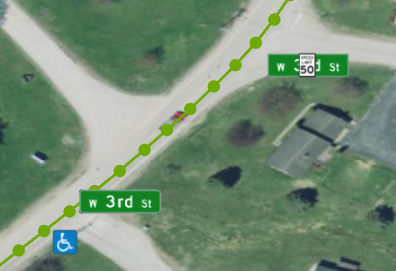
Stay fully compliant with the federal Model Inventory of Roadway Elements (MIRE) standard. Maplyzer's asset extraction captures the elements required for MIRE reporting as part of the same automated pass, producing accurate, audit-ready records without a separate manual data-collection effort.
Special Attention to School Zones
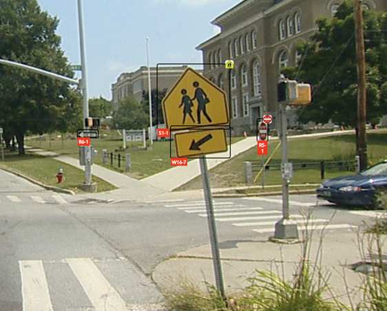
Asset Intelligence gives particular focus to school zone signage, given the scale of school-transportation-related incidents nationally.
Keeping school zone signage inventoried, visible, and in good condition is one of the highest-leverage things an agency can track.
What Are the Benefits?
- Automated sign, guardrail, and asset detection at scale.
- Audit-ready records aligned to MIRE requirements.
- Assets grouped, sorted, and searchable by tag, location, and date.
- Support for processing your existing imagery, not just new captures.
- Multi-year change detection to catch what a single inspection would miss.
Asset Intelligence is powered by MapAssets, Maplyzer's asset detection and inventory engine.
See the MapAssets interface →