
Roadway Intelligence
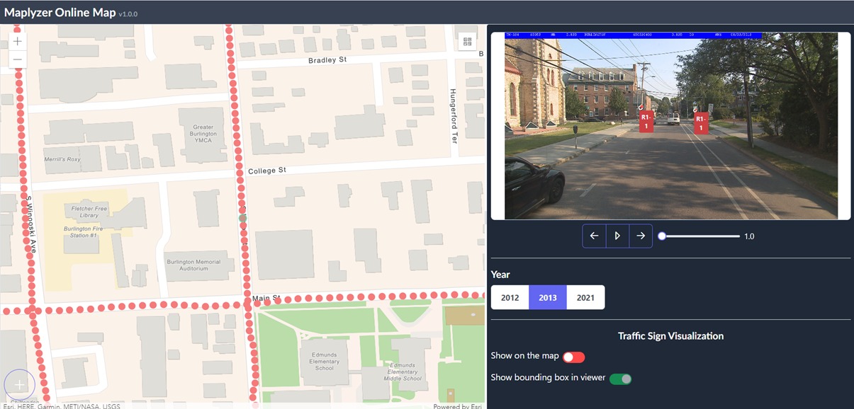
Turn street-level imagery and video into a current, mapped inventory of roadway assets and conditions without sending a crew out for every mile.
- Identify road assets and place them on a map with high accuracy.
- Access imagery from any location, at any time, from your desktop.
- Analyze roads and critical safety assets across multiple years.
- Track condition and asset changes over time, not just a single snapshot.
- Upload and store your own imagery securely, in the cloud or on your own servers.
Road Asset Management
The Problem
Most agencies still track roadway assets the way they did a decade ago periodic manual inspections, spreadsheets, and institutional knowledge that walks out the door when someone retires.
The Operational Impact
Inventories fall out of date between inspection cycles. Maintenance and budget decisions get made on data that's months or years old, and audits or federal reporting take longer than they should.
How Maplyzer Helps
Maplyzer processes the imagery you already collect or new footage from dashcams, mobile mapping units, or drones and builds a geo-tagged, time-stamped inventory of roadway assets automatically.
Infrastructure Condition Assessment
Beyond simply knowing an asset exists, Maplyzer flags changes in condition and visibility over time so teams can prioritize repair and replacement based on what's actually changing on the ground, not just what happens to be due for a scheduled inspection.
Multi-Year, Multi-Image Tracking
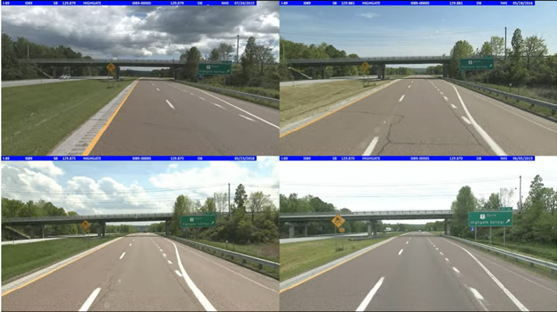
Track and visualize road assets across multiple frames over multiple years. Maplyzer identifies new and missing assets and reports them back to your team, building a multi-year dataset and a clear condition history for every asset on the network.
What Are the Benefits?
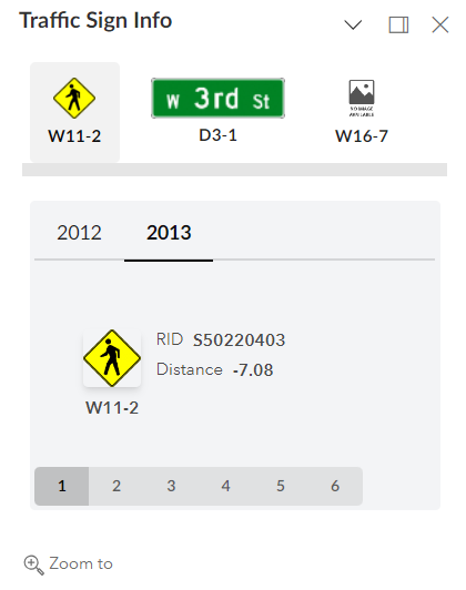
- Detailed maps with roadway asset information, always current.
- State-of-the-art AI to extract and analyze road assets.
- Rich visuals combined with comprehensive metadata.
- Practical tools to generate reports and share information across teams.
- Full compatibility with your existing Linear Referencing Systems (LRS).
- Dedicated technical support expert at your service.
Roadway Intelligence is powered by MapRunner, Maplyzer's mapping and imagery engine.
See the MapRunner interface →